Vitry-en-Artois
Appearance
Vitry-en-Artois
| |
|---|---|
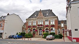
 The town hall of Vitry-en-Artois | |
| Coordinates: 50°19′35″N 2°59′02″E / 50.3264°N 2.9839°E | |
| Country | France |
| Region | Hauts-de-France |
| Department | Pas-de-Calais |
| Arrondissement | Arras |
| Canton | Brebières |
| Intercommunality | Osartis Marquion |
| Government | |
| • Mayor (2020–2026) | Pierre Georget[1] |
Area 1 | 18.78 km2 (7.25 sq mi) |
| Population (2021)[2] | 4,787 |
| • Density | 250/km2 (660/sq mi) |
| Time zone | UTC+01:00 (CET) |
| • Summer (DST) | UTC+02:00 (CEST) |
| INSEE/Postal code | 62865 /62490 |
| Elevation | 41–72 m (135–236 ft) (avg. 48 m or 157 ft) |
| 1 French Land Register data, which excludes lakes, ponds, glaciers > 1 km2 (0.386 sq mi or 247 acres) and river estuaries. | |
Vitry-en-Artois (French: [vitʁi ɑ̃n‿aʁtwɑ]; literally "Vitry in Artois"; Picard: Vitry-in-Artoé or Vitry-la-Gueule) is a commune and in the Pas-de-Calais department in the Hauts-de-France region of France.[3]
Geography
[edit]Vitry-en-Artois is situated some 12 miles (19 km) northeast of Arras, at the junction of the N50, D39 and the D42 roads. The river Scarpe flows through the town, which is also served by the SNCF railway. The World War II German airfield was later used by the Americans, then after the war, was put to commercial use as the local aerodrome.
Population
[edit]| Year | Pop. | ±% p.a. |
|---|---|---|
| 1968 | 3,593 | — |
| 1975 | 4,748 | +4.06% |
| 1982 | 4,738 | −0.03% |
| 1990 | 4,732 | −0.02% |
| 1999 | 4,606 | −0.30% |
| 2007 | 4,388 | −0.60% |
| 2012 | 4,600 | +0.95% |
| 2017 | 4,677 | +0.33% |
| Source: INSEE[4] | ||
See also
[edit]References
[edit]- ^ "Répertoire national des élus: les maires". data.gouv.fr, Plateforme ouverte des données publiques françaises (in French). 2 December 2020.
- ^ "Populations légales 2021" (in French). The National Institute of Statistics and Economic Studies. 28 December 2023.
- ^ INSEE commune file
- ^ Population en historique depuis 1968, INSEE
Wikimedia Commons has media related to Vitry-en-Artois.


